
What is a domain? For resource estimation, the domain is a spatial volume where:
1. the geology is consistent (homogeneous)
2. contains a single grade population
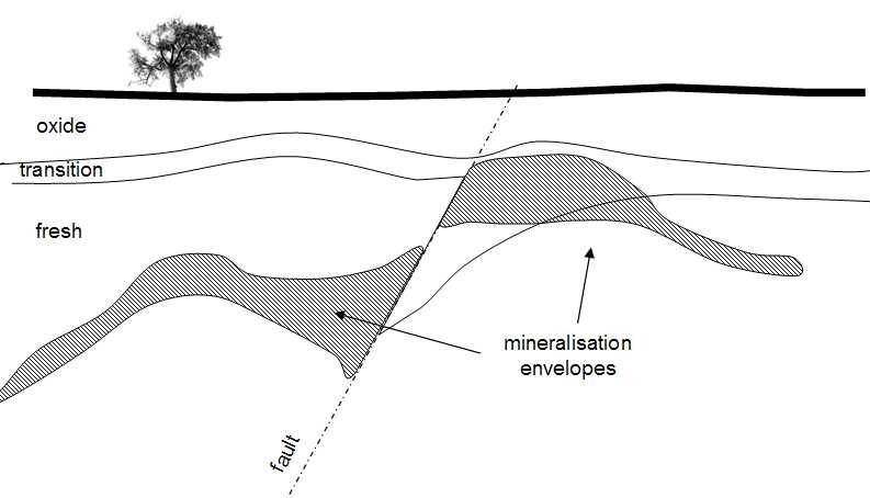
3. has a single orientation for search One expects different geological units to mineralise differently. It naturally follows that the homogeneity of the geology lends support to the mineralisation envelope – when we can understand the origin of the mineralisation, we will be more confident in how far to extrapolate the mineralisation continuity (figure 1)

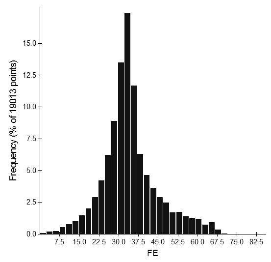
The second requirement of a domain is that it contains a single grade population. When we fail to meet this criterion, our estimates reflect neither the lower nor the higher-grade population. The estimates we produce tend to be over-smoothed between the two underlying populations (Figure 2). When the histogram shows evidence of two populations, we need to return to our data and attempt to separate the populations spatially (Figure 3 and Figure 4).


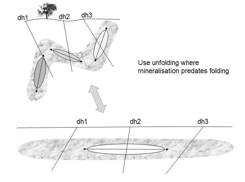
The third requirement of a single orientation of continuity ensures the search ellipsoid and variograms are orientated in the best alignment for the grade continuity during estimation. Mineralisation volumes that have undergone folding post mineralisation should be unfolded prior to data analysis. This way the appropriate samples can be aligned for analysis and estimation (Figure 5).
The purpose of building and defining domains is to control the use of sample data during estimation – we only want to use what is relevant to the volume we are estimating. Domains highlight changes in geological texture, statistical population and/or orientation of continuity.
Consider the geological context below. Can you identify the domains? Consider structural, lithological and weathering controls, as well as changes in orientation and anisotropy.
Dear Reader if you are interested in getting started with 3D geological modelling and domain building check out our free Videos on youtube and if you like them you can continue with the paid course ( check video description) .